View of Mounts Lidgbird and Gower from Transit Hill
[ << previous | index | next >> ]
We rose earlier this morning to make sure we left by 08:30 in order to walk over to the meteorology station out past the airstrip in time for the release of the daily weather balloon at 09:30. Cheryl had told us about it on the drive from the airport to our lodge, and said that visitors are welcome to come and watch, and the station staff give a bit of a talk about it. She said it was quite popular with island visitors.
So we walked along Lagoon Road out to the west end of the runway, then all the way along the northern side to the eastern end where we could go around it and approach the met. station. We got there at 09:05, after crossing the cattle grids on the driveway to pass through a cow paddock that seemed to completely surround the station. We sw the balloon inflated in a shed and ready to go, so figured we'd made it in good time. We sat on some steps to wait.
A couple of minutes later a man came out of the office behind us, walked over to the balloon, turned around, and jumped when he saw us sitting there. He came over and said we were a bit early - the balloon wasn't going until 10:15. When we looked surprised, he said that some people were still telling visitors that it was 09:30, and he asked us where we were staying. We said "Somerset", and the man said, "Oh, yes, I told Cheryl two weeks ago that we'd changed to 10:15 - she asked specifically. We change for daylight savings. She's a bit forgetful." He suggested we take a short walk down to Cobby's Corner and the beach there to sit for a while as we waited.
We took his advice and made the short trek, taking a seat at a picnic table shaded beneath a fig tree. I took a walk out on the rock shelf at the southern end of the beach to look at the views and take some photos. Returning to the picnic table, I had a need to use a toilet, so we left and walked back down the road past the met. station to the airport. The terminal building was closed and dark, but a pull on the front door opened it up, so we went in and I availed myself of the amenities.
With 15 minutes to go until the balloon release, we just sat in the deserted and dark airport building and flicked through magazines until it was time to go. We went back next door to the met. station, where two men and a young boy were waiting near the balloon.
The meteorologist reappeared and started to explain to us about how the balloon is inflated (using electrolytically produced hydrogen), how much it's inflated (until it can lift 2 kilograms), how fast it ascends (300 metres per minute), how high it goes (35 km), and how big it expands to before it bursts (40-50 metres). At ground level it was about 2 metres across, a white sphere with a string below holding a silvered radar reflector about 50 centimetres across. He showed us an electronic instrument package before he attached that to the string - containing a thermometer, hygrometer, barometer. It was attached via a spool that unwound at a measured rate, to allow the instrument package to float well below the balloon as it expanded at higher altitude, to avoid turbulence caused by the balloon itself.
Then we walked out into the field and he said that some days when the wind is really strong the balloon got blown fast enough for the instrument package to get caught in the stand of Norfolk Island pine trees away to our west. He let the balloon go and it climbed rapidly, blowing westwards as it went - missing the trees by a good margin. Then he went to a small sighting telescope near the building and swivelled it to point at the balloon. We heard a beeping noise and he said the radar (in a radome behind the station building) had locked on to the balloon and would track it now for the next two hours.
Then he took us inside to show us the radar tracking and instrument readings on the computers. First he went to the radio receiver to check the instrument package and found that it was on the blink.
"This was working just before!" he said. "It was working yesterday until I sent the balloon up, then stopped. I sent for a replacement unit from the mainland, then another worker came in and asked me why I'd turned it off - he turned it on and it was working again. And now it was working this morning, up until now - but now it's dead again!"
So he showed us the radar signal instead, which showed the balloon was already 2 km away and at an elevation of 35°. The windspeed calculations were done automatically and being printed out line by line every few seconds for different altitudes. Then he started giving us all a talk about all sorts of weather stuff, how they take the readings, do up the maps, etc, etc.
It was interesting and I would have liked to stay longer, but we had some walks planned for the day and we were already 45 minutes later than planned. We hadn't brought any lunch as we expected to be back by lunchtime, so needed to get a move on, and excused ourselves. The other men said they should leave the guy to his job too, and the meteorologist said, "Oh, you don't have to go - I've got nothing to do for the rest of the day now with the radio receiver not working."
We set out on the coastal track to Muttonbird Point on the east side of the island. The walk began up a narrow sloping paddock and then into palm forest. We climbed the ridge for a short distance until we reached the junction of the Intermediate Hill track and turned left to traverse the hillside rather than climb up it.
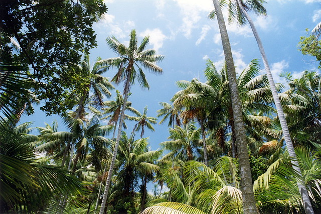
The track wound through a thick forest of palms - which I noticed were mostly curly palms, rather than the kentia palms common on the flatter areas. The early cloud had burnt off and the day was getting quite warm. Thankfully we were under the forest canopy much of the time. The walk undulated up and down a little, but was fairly flat.
Eventually we reached the turnoff from the Rocky Run/Boat Harbour track to Muttonbird Point. We walked down the hill to the viewing platform, from where we saw lots of nesting birds on the point - masked boobies, sooty terns, noddies, shearwaters. We rested to have some muesli bars and water, and to top up our sunscreen, then started the trek back. The walk back gave us several good views of Blinky Beach, from where the sound of the surf carried loudly to us along the track.
Back at the road, we rounded the end of the airstrip again and started on the track leading up to Transit Hill. Although this walk was easy, the slight uphill grade and our tired state made it fairly slow going. We eventually reached the summit of this hill, where a plaque indicated that it was the site for a measurement of a transit of Venus some years ago - and the name of the hill. A raised platform above the treetops gave us spectacular 360° views right round the island.
 View of Mounts Lidgbird and Gower from Transit Hill |
Then we headed down the north side of the hill and towards the village. The track was fairly flat, descending only slowly. We emerged from the forest at the top of a hillside paddock, accessed over a fence by a stile. A marker post showed the path down the paddock, turning right past the back of the bowling club, to emerge on the road near the liquor store. So we set out (after Michelle took some "The hills are alive..." photos of me...) down the hill, following a set of wheel tracks through the tough tussocky grass.
 Kentia palms near Transit Hill |
As we approached the bottom of the hill, we could see that we had to turn right somewhere, lest we emerge on a lodge property on the wrong side of the bowling club to where we were supposed to find the road. We noticed another set of wheel tracks leading right, so took those. After following them for a while, they looped around back towards the lodge, rather than past the back of the bowling club. We could see some forest just past the bowling club and figured we just needed to get there, so left the tracks and walked cross the rough humpy grass past the back of the club towards the forest.
Once we got to the forest though, we found ourselves fenced off by an electric fence. We walked along it for a while, thinking there must be a stile somewhere so we could cross it, until we reached a point where the hill started to rise steeply, with the fence continuing unbroken up it. We were stuck in a paddock with a bunch of cows, surrounded by an electric fence, with no apparent way out in the direction we needed to go!
Sick of walking uphill by now, we backtracked about 200 metres past the bowling club again to find an exit near the lodge on the far side. Squeezing out of the paddock through a narrow gate, we walked through the lodge property and finally emerged on Lagoon Road.
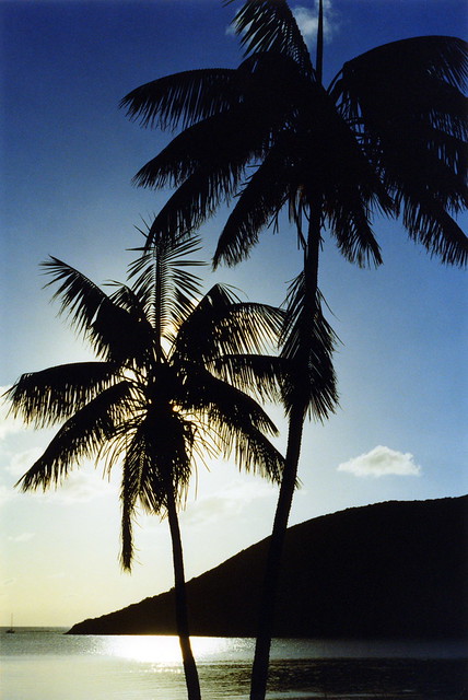
 Kentia palms on the coast |
We walked back through the familiar laneways to Thompson's Store, where Michelle got a large iced coffee drink and I got a chocolate chip and crème brûlée ice cream, which we devoured on the way back to our cabin.
Once back, we washed ourselves down with wet towels to cool off. I fired up the barbecue to cook the remaining sausages for lunch, while Michelle laid down for a rest.
At 18:00 we walked over to Milky Way to see if they had fish for the fish 'n' chips combos tonight. They did, so I ordered a hot seafood combo - fish, prawns, calamari, and chips. They were rather busy, with a lot of people waiting and lots of other people arriving later and picking up orders they'd phoned ahead. We had a wait of about three quarters of an hour, which jeopardised our plans to walk out to a place suitable to watch the sunset after eating. Instead, we had to leg it out there as soon as we got the food and rush to take some photos before eating.
 Sunset |
On the positive side, the sky was mostly clear and and sunset was the best and most beautiful we'd seen yet. We ate after taking some photos, basking in the glory of a gorgeous pink sky over the lagoon in the west.
After sunset, we walked back to Somerset for our last night on Lord Howe. The full moon was just rising over the palm trees ahead of us as we walked east along the road.
[ << previous | index | next >> ]