On the ferry from Cronulla to Bundeena
I went on a bushwalk yesterday - Sunday 10th Sept. It was my first chance to get out and about again after submitting my thesis. The walk was organised by a guy called Danny - who happened to be the person who proofread my thesis - and there were supposed to be a few other people coming along, but we were the only ones who showed.
The day could have begun better for me. My alarm went off, I jumped out of bed, dressed quickly, rushed out to the kitchen to get breakfast - and then I noticed it was still dark outside. Surely the sun should be up by now... I checked a clock. 5:30!! I'd intended to set my alarm for 6:30. Not wanting to hang around for an hour in the morning gloom, I reset the alarm, got undressed, and jumped back into bed.
At 6:30, I really got up. I could see without turning on the lights, which was nice. I had some breakfast and caught a train into the city. There I met Danny and we caught another train out to Cronulla, which is a beach suburb on Port Hacking (the next bay south of Botany Bay). South of Port Hacking, and extending almost as far south as Wollongong, is the Royal National Park (Australia's first, and the first national park outside the USA).
The Royal National Park was devastated by the bushfires of January 1994 (which most of you probably heard about at the time). This was a chance to see how well the bush had recovered.
We picked up some sandwiches for lunch at Cronulla, then took the ferry across Port Hacking to Bundeena - a small community which is actually inside the grounds of the National Park. The residents have special stickers on their cars so they don't have to pay the Park entry fee. (Bundeena was totally evacuated during the 1994 fires - by boat because the road was cut.)
 On the ferry from Cronulla to Bundeena |
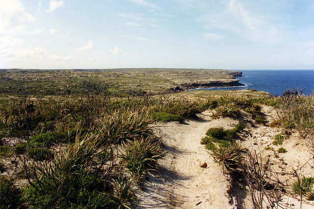
We left Bundeena at 10:00, taking a looping walk out on to the promontory there. This turned out to be a bit of a mistake, because the promontory is mostly sand dunes, and the going was tough and slow over the loose sand. There was scrubby vegetation to keep the sand there, but the track we were walking on had no vegetation, so the walking was difficult. It also started raining, but that only lasted a few minutes. We were grateful for the cloud cover, though.
 Sand walking track among the burnt trees |
At about 11:00, we completed the loop, ending up about 200 metres up a bitumen road from where the ferry had docked.
After that little warm-up, we set off on the real walk... 25 kilometres of scenic clifftops and beaches. I'm glad it wasn't more sand dunes! Our destination was Otford, from where we could catch another train back into the city (the train line skirts the western edge of the Park).
The coast between Bundeena and Otford consists of alternating sandstone cliffs which drop straight into the Pacific Ocean and partially sheltered coves containing beaches. The beaches were Wattamolla, Curracurrang, Curracurrong, Big Marley, Little Marley, Garie, North Era, South Era, and Burning Palms. Wattamolla is about a third of the way to Otford, so the first part of the walk was mostly clifftops.
 The ocean, and Danny walking ahead on the track |
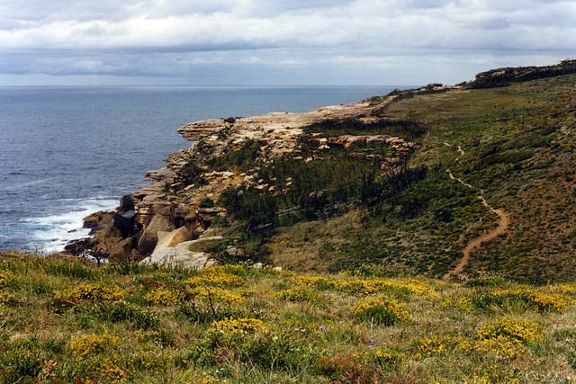
The sandstone cliffs were about 50-60 metres high, which meant you could see an impressive amount of ocean. A few yachts were out there, using the breeze to their advantage, and there were a couple of large cargo ships perched on the horizon. The sea was calm, but there was quite a wind on top of the cliffs.
On the odd occasion where the land jutted out into the see, you could look back at the cliffs to north and south - quite spectacular. I took several photos (some of which will eventually make it on to my Web pages, no doubt).
 The track along the clifftops |
The vegetation was pretty sparse - sort of wind-blown heath in appearance. Oh, of course there was nothing very big, because the fires had ravaged it some 20 months ago. Banksia trees, about the height of a person, were uniformly blackened and dead for as far as the eye could see. Low scrub had grown quickly enough to be the dominant form of plant life, and formed a green carpet at about shin height. No doubt there were banksia saplings amongst them, just waiting for time to give them the advantage of height over the scrub. It was rather an unreal landscape, with so many dead trees everywhere.
 Sandstone cliffs |
As we approached Wattamolla, we moved into areas that hadn't been burnt. Here the banksias were alive and well, and the undergrowth wasn't quite so vigorous. We crossed the stream above the waterfall and found ourselves amongst people again.
Wattamolla is a fairly popular recreation area. A road leads to it through the Park, and there is car space for about 200 vehicles. Even on a mild day this early in spring, there were a fair number of people there. A stream leads to a pool atop a cliff about 8-10 metres high. From there it plunges over a waterfall into a deep lagoon. People like jumping off the cliff into the lagoon. The beach is a spit of land which cuts off the lagoon from the sea at low tide. There are large grassed areas as well, perfect for picnics and such.
We stopped at the kiosk to buy ice creams. We also bought some drinks when we discovered that the tap water was undrinkable (we had planned to refill our water bottles here). Then we struck out into the wilderness again.
 Looking south along the coast |
We walked along another clifftop to the next beach. Curracurrang and Curracurrong were really tiny - basically just gullies where a stream entered the sea. They did necessitate descending down from the cliffs into the valleys, stepping over the streams, and ascending the other side. Some of the climbs were quite steep, and the views over the valleys were wonderful.
 Curracurrang Gully |
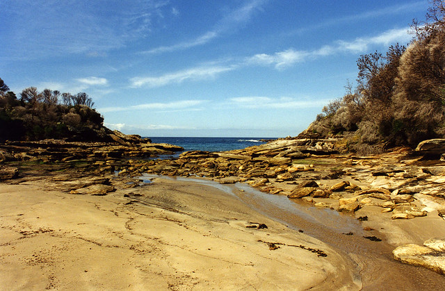
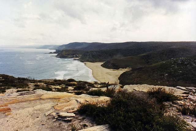
Then came the descent to Big Marley, which involved clambering down piles of rocks until we reached a large flat expanse of sand. There were a few surfers there - who had probably walked over from Garie, but it was otherwise deserted. We walked along the sand until we reached an outcrop of the plateau above which extended out into the sea again. We skirted around the base of this, using the wide rock ledges at the cliff base, to reach Little Marley. After crossing the sand, we climbed back up to the top of the cliff again.
We did a similar trek down to the beach at Garie. There were quite a few people here, since this is another beach with road access. From there, we skirted the cliff bases again to reach in turn North and South Era beaches. The section between Garie and North Era was most impressive. There was a tumble of large sandstone boulders, forming a sort of beach with giant sand grains, if you can picture what I'm saying. Of course, these boulders had to come from somewhere... looking up at the cliff-face, I could see that it was irregular and with a broken "chopped-up" appearance. Some of the large slabs of rock looked as though could have fallen at any minute. None did, thankfully.
 Looking north, back the way we'd come |
South Era was the last sand we actually set foot on. Danny pointed out at that time, while we were standing at sea level, that Otford was on top of the escarpment, at an elevation of over 200 metres...
Following the track, we turned inland slightly, trekking up the face of a grassy hill and down the other side towards Burning Palms beach. On the south side of the hill, the vegetation changed dramatically. There were palm trees everywhere all of a sudden. I expressed some surprise, only to have Danny point out that the place was called Burning Palms.
Here the geography changed too. There were no longer sheer sandstone cliffs plunging into the sea, but the plateau instead sloped down at an average angle of about 45°, providing plenty of purchase for a thick covering of palms and other plants. The track didn't go down to the beach, but wove through the palms a few metres above sea level.
 Towards Burning Palms |
A brief reappearance of cliff necessitated climbing up over a hill and back down into an area noted on the map as Palm Jungle. This was even more thickly vegetated. It was actually a small pocket of temperate rainforest - and it certainly looked the part. There were numerous palm trees, mixed with other trees - mostly eucalypts - with lots of vines all over the place and the odd strangler fig wrapped around some other unfortunate tree. The path wound through the trees, quite dark because of the canopy overhead. I wouldn't have been surprised to have picked up some leeches - but thankfully didn't.
From Palm Jungle, the path took a determined uphill direction. By this time it was after 5pm, and sunset was approaching, so we couldn't exactly dawdle, but we stopped a few times to rest and drink water. The palms disappeared as we climbed, giving way to eucalypt forest. And that's when we saw them.
It was a bush-sized plant, with smooth, long, bright green, strap-like leaves splayed out from a base, with no stem visible. The leafy bit was about a metre high, but from the centre rose a single stalk, dead straight, dead vertical, about five centimetres in diameter (thinning a little towards the top), with a single flower on top. The flower was dull red, but still dramatically vibrant, and about the size of a large cauliflower or cabbage, and the stalk was at least four metres high, maybe five or more. I know I'm 183 cm tall, and this flower was at least 2 and a half times as high as I was. I later found out they were gymea lilies (Doryanthes excelsa).
 Gymea lilies |
We stood and gawked at it for a while, but unfortunately it was in a bad position to photograph. When we turned the next corner, there was a whole group of them. As we continued there were more and more. I managed to get a shot of a small group in the fading light - and I really hope it turns out. They were amazing.
Eventually we reached the top of the ridge and from there it was a relatively simple walk through the eucalypts to Otford. Just before Otford was a lookout, where we could see the ocean, and the sky, in the rapidly darkening dusk. It was beautiful.
I got home just after 8:30pm, had a hot shower, some toasted cheese sandwiches, and went to bed. It had been tiring, but it was a great day.